About the research
Trees are an important source of food and fuel for local communities all over the world. It is thus important to map them, so as to be able to protect them. But how do you start mapping millions of trees? Well, by combining satellite images with digital image processing technology. Problem solved? Not yet, as even computers can have a hard time recognizing trees on top-down satellite images of the Earth's surface. Maria Culman (KU Leuven - VITO) explains how she intends to overcome this challenge.
Agriculture
Technology
Contact Maria

Gerelateerde video's
ILVO
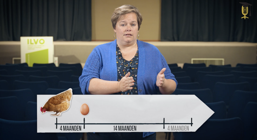
How can we support old laying hens to keep laying good eggs for longer?
Did you know that laying hens stay on a laying farm until they are 18 months old? "But maybe this could be 4 months longer, provided their health, welfare, and egg quality are still fine," says Karolien Langendries (ILVO). Together with her colleagues, she investigates what support old laying hens need so that they can lay good eggs for longer.
ILVO
KU Leuven
Is Japanese holly a good alternative to boxwood?
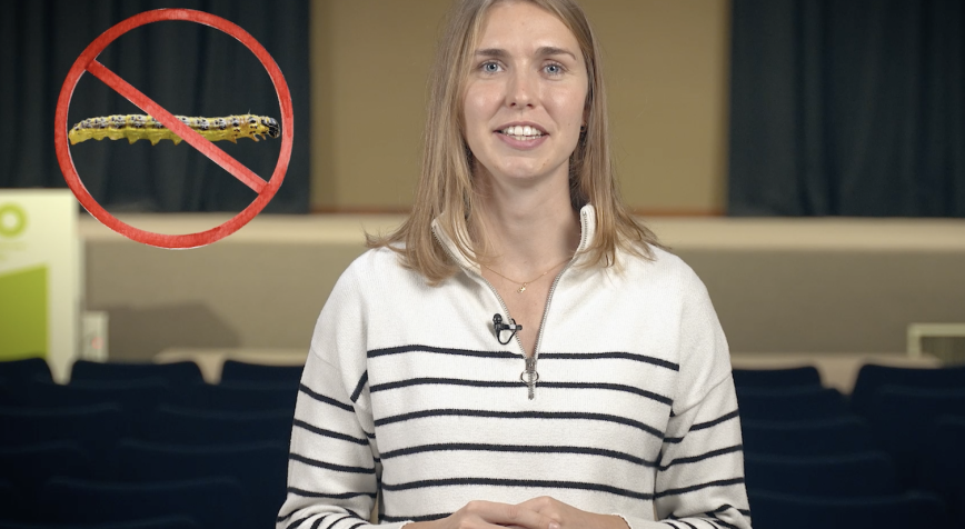
Away with bare boxwood bushes! The infamous boxwood moth went on a rampage in Flanders in recent years 🐛🌳 But don't panic! Meet Japanese holly, a robust alternative that is immune to these voracious caterpillars. The catch? The soil in many Flemish gardens is not acidic enough for this shrub to grow well. Bioengineer Esther Geukens will therefore tinker with the plants and the soil so that Japanese holly can thrive here.
ILVO
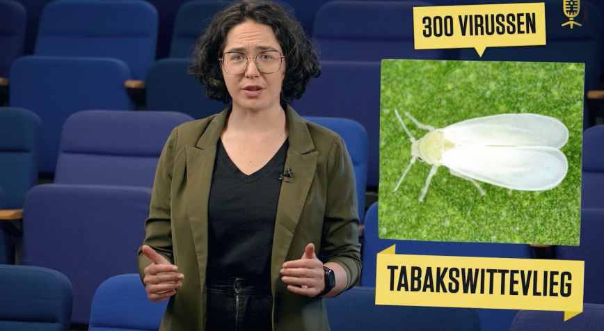
In search of tobacco whiteflies and their transmissible viruses
The tobacco whitefly, an exotic fly smaller than a grain of rice, can kill almost any vegetable in a greenhouse. These flies already turned up in greenhouses of vegetable growers in our country, but we don't know how big the problem is. At least, for now. Because Fauve Maertens (ILVO) wants to change that by mapping the spread of the tobacco whitefly.